News Summary
Columbia, SC is currently under severe weather warnings, including a tornado warning until 8:15 a.m. and a severe thunderstorm warning until 8:30 a.m. Residents are advised to take precautions as the National Weather Service warns of potentially damaging winds and localized flash flooding throughout the day. Additionally, a broader tornado watch is in effect for Richland, Lexington and surrounding counties until 2 p.m. The situation remains hazardous with power outages and strong winds expected.
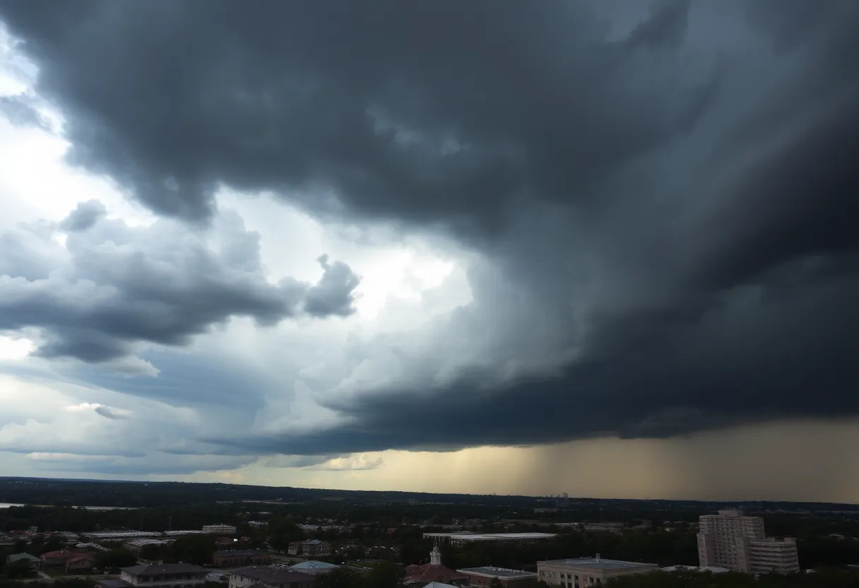
Severe Weather Warnings Blanket Columbia, South Carolina
Columbia is bracing itself for a tumultuous day as both a severe thunderstorm warning and a tornado warning were issued early Sunday morning. Residents in the area are advised to stay alert and prepare for potentially dangerous conditions.
Tornado Warning in Effect
The tornado warning is currently active until 8:15 a.m., giving locals a short window to ensure they’re safe and secure. This alert follows the announcement of a severe thunderstorm warning, which is ongoing until 8:30 a.m. The National Weather Service has indicated that the threat of severe weather is expected to persist through Sunday afternoon, so residents should be vigilant.
Widespread Tornado Watch
A wider tornado watch has also been issued, lasting until 2 p.m. This alert affects Richland and Lexington counties as well as nearly all of the Midlands — including Kershaw, Sumter, Calhoun, Clarendon, Lee, and Orangeburg counties. Folks in these areas should remain aware of changing conditions and take necessary precautions.
Increased Tornado Threat
Thunderstorm Warnings and Risks
In addition to tornados, a strong cold front is ushering in strong-to-severe thunderstorms, localized flash flooding, and even gusty winds. Conditions in Columbia could see wind speeds reaching up to 60 mph, a troubling prospect as it raises the risk of considerable damage to trees, mobile homes, roofs, and vehicles.
Power Outages and Other Hazards
The winds could lead to downed trees and power lines, resulting in power outages across the region. People should stay away from large trees and avoid driving if possible until the storms pass.
Lake Wind Advisory
Rain Forecast and Future Outlook
The forecast for Columbia on Sunday is rather gloomy, with a predicted 90% chance of rain. Rainfall amounts could reach up to half an inch, with some localized spots possibly picking up even more. However, brighter days lie ahead! Following this potentially stormy Sunday, we can expect drier conditions, with temperatures set to soar from the 60s to a toasty 78 degrees by Wednesday.
Stay Updated!
As the day unfolds, further updates concerning the weather situation will become available. Residents are encouraged to stay tuned to local updates and make safety a priority. Remember, being prepared is always better than being caught off guard!
Stay safe, Columbia!
Deeper Dive: News & Info About This Topic
HERE Resources
Severe Thunderstorms Expected Across South Carolina This Weekend
Severe Weather Heading to Columbia: Are You Prepared?
Columbia Water Crews Repair Water Main Break Amid Cold Snap
Columbia Faces Major Sewage Spill Warning
Winter Weather Alert for Columbia: SCDOT Prepares for Wintry Mix
Columbia Residents Unite to Support Homeless Initiative
Irmo Families in Shock Following Series of House Fires
Cold Weather Advisory Set to Chill South Carolina Residents
Dense Fog Advisory in South Carolina: Commuters Beware
Columbia Water Maintenance Work This Weekend
Additional Resources
- The State: Severe Weather Warnings
- Wikipedia: Tornado Warning
- Columbia Missourian: Storm Damage Response
- Google Search: Severe Thunderstorm Warning
- WLTX: Tornado Watch in Effect
- Encyclopedia Britannica: Tornado
- KMU: Tracking Strong to Severe Storms
- Google News: Tornado Warnings South Carolina
- ABC Columbia: Storms to Move Through the Midlands