Cayce Residents Keep an Eye on Rising Waters
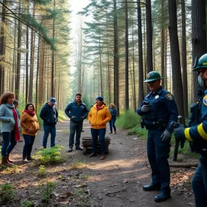
Over the weekend, the city of Cayce found itself under constant watch as the Congaree River, fueled by rain from Tropical Storm Helene, began to rise and create concerns for residents. With water levels steadily increasing, city officials took swift action and advised some residents to evacuate to ensure their safety.
How to Stay Informed with Real-Time Updates
If you’re in the area or just curious about the river’s current conditions, the U.S. Geological Survey (USGS) has rolled out a fantastic tool to keep you informed. They have installed a live, interactive camera located at the Congaree River below Cayce. This means that anyone with a smartphone and an internet connection can check on the rising water levels at any time! All you have to do is visit the USGS website, and you can monitor the river’s status in real time.
To use the live webcam, simply follow these steps: first, press the “play” button in the middle of the screen to start monitoring. Next, click the “control” button at the bottom, which allows you to move the camera around. You can shift the camera’s view left and right, and adjust the angle up and down using the sliders. There’s even a zoom feature! This is especially useful for getting a closer look at specific areas of concern. The camera runs during the day, but keep in mind that it’s turned off at night to save battery power.
Impact on Local Areas
The rising waters have impacted several key areas in the city. Notably, the Cayce Riverwalk and the Timmerman Trail are currently closed due to flooding, as is the 12th Street Extension located near the Amazon Distribution Center. Furthermore, the beloved Gervais Street Bridge and all other bridges in Columbia spanning the Congaree River have also been shut down.
As of Monday morning, the river has crested just over 30 feet, which is approaching levels seen during the disastrous “1,000-year flood” that hit the Midlands back in 2015, measuring at 32 feet. This indicates just how serious the situation has become, stressing the importance of staying updated with reliable information, especially if you live nearby.
Community Support During Flooding
While Mother Nature throws her challenges at the city, local organizations and community leaders are working hard to keep residents informed, safe, and calm. Evacuations and road closures can be tough, but it’s essential for everyone’s safety. If you’re in the immediate area, remember to adhere to any evacuation orders or advice given by local authorities. Your safety is the priority! And don’t forget that technology has your back with tools like the USGS camera helping you stay informed.
Looking Forward
As we look ahead, the community remains hopeful that conditions will stabilize soon. With residents and officials working together, along with the invaluable resource of real-time information, Cayce is working to weather this storm. Whether you’re monitoring the Congaree River from the comfort of your home or finding alternative routes around closed roads, remember to take care of yourself and your neighbors.
Stay safe, Cayce! Together, we’ll navigate through these challenging waters.